Not long ago, Lei Fengnet (searching for "Lei Feng Net" public concern) had interviewed Wei Wei, director of Velodyne LiDAR's Asia Pacific region. In April this year, he alone completed the company's sales target for the Asia Pacific region. At the time, he was in excitement. , also told us about the story behind Velodyne. On August 12th, at the CCF·GAIF global artificial intelligence and robotics summit, we had the privilege of interviewing Michael Jellen, president of Velodyne LiDAR, who explained why LiDAR is expensive and plans for future development in the Chinese market.
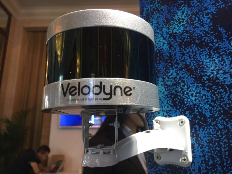
Although the accuracy of LiDAR is very high, the price is not cheap, and Bai Wang, senior vice president of Baidu, “drained hardships†at the conference: when he purchased a LiDAR, he had to pay 700,000 RMB. With regard to expensive prices, Jellen explained that the problem is that the current market demand is still very small, if there are millions of LiDAR orders now, you can give very favorable prices. The number of vehicles purchased by the depot is small, and the technology used by LiDAR is very expensive, so this is the relationship between chickens and eggs. The cost reduction needs to wait for large quantities of demand. However, they are also working hard to negotiate with suppliers.
Previously we reported that LiDAR's production process is complex and it is indeed a challenge to achieve mass production. Jellen said that they have established a better supply chain system and sought out various related accessories manufacturing companies. Last year they opened an office in Beijing, and must also consider the issue of production. Jellen revealed that considering the expansion of customers, not only Beijing, but also other offices in other places, on the one hand, mainly for some car manufacturers to provide good technical and service support, and consultation with Chinese manufacturers to ensure mass production. On the other hand, it is hoped that technical R&D will be supported.
In addition, at present, the development of automated driving encounters various challenges. From the technical perspective, Jellen believes that hardware has enough manufacturers to support, but the biggest bottleneck is the software, how to make judgments in real time, and make Some of the functions that are currently enabled by default, such as going straight and avoiding obstructions, may take five years.
In the speech at the conference, Jellen also explained in detail the difference between the excited radar and the general radar technology and the camera.
LiDAR and Radar and Camera Advantages and DisadvantagesFirst of all, both LiDAR and radar technology can perform a survey of the road conditions better, telling people what kind of roadblocks are ahead and finding roadblocks. At the same time, both technologies perform better under normal weather conditions. Moreover, radar technology can sometimes reflect the hidden road conditions outside the roadblocks, but radar technology is also flawed.
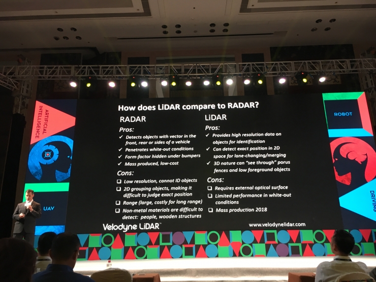
The first lack of high-definition technology, it is a two-dimensional technology, technical limitations are relatively large, if people are far from the car, then when the two radar and camera are used together, the photos returned are not very clear, of course, can also be used Military radar improves the clarity of photographs, but it is not used much now.
What are the advantages of LiDAR Lidar? The first is high-definition, and all of its photos or information are in high definition. Second, it is no longer a two-dimensional image but a 3D image. This can not only observe the details of the object, but also make judgments based on the actual specifications of the object. For example, the actual distance and size between a closer object and a more distant object, and it also brings a relatively light-loaded camera without reflection on the obstacle. In fact, LiDAR lidar technology is not currently mass-produced, but it is predicted that after 2018, it will be produced and manufactured on a large scale.
Look at the camera and LiDAR again. The camera itself is a very good technology like a radar. It is low in cost and widely used. It is also light, but it has its own limitations. First, the photo taken by the camera has a lot to do with lighting. If the light is good, Photos are clear, but sometimes there are shadows in the light that affect our judgment. Imagine a family taking a picture together. It may be 10 meters away. The picture looks good, but if you take a picture outside the 200 meters, you can't see anything. This is the camera's limitation.
LiDAR's photos are absolutely high-definition, clear enough, and unaffected by the light. Whether it is morning or evening, the photos are very high-definition. In addition it can also meet the long-range camera needs. Regardless of whether the lights can't be turned on or the lights can't be turned on, LiDAR doesn't have any requirements for the surrounding ambient light. The returned photos can ensure high-definition.
The cost of the camera will be lower, so it is widely used, but in the future, if the LiDAR produced every year can reach two or three million, its cost may be much lower. In the future, each unmanned car will carry one or two LiDARs, and the entire cost will be reduced with large-scale production and application.
LiDAR can achieve specific functions3D image recognition roadblocks and road signs
At the conference, Jellen shared some of the advantages that LiDAR can achieve. The first is a 3D image. LiDAR will provide a map with road signs and roadblocks. When people open from A to B in a strange city, they will be very focused on the items around them and sometimes get lost, but if they go three or four times, they will not get lost again. At the same time, you will not focus on the roadblocks or road signs on the road as you did for the first time.
The same is true for 3D HD images provided by LiDAR. The driver will drive to an intersection. We will see a signpost. When we see something in the air, we will judge what it is. It is a road sign or a bird. The 3D HD image will tell us which is the mountain in the distance and which is The car, which is the building, and the human brain requires continuous and complex repetitive work so that the brain can distinguish this information.
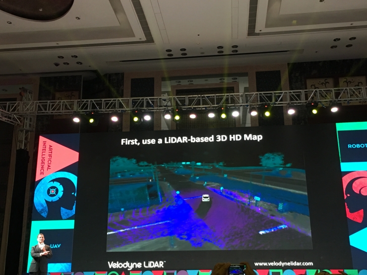
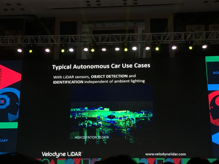
No matter how high the road is, or how long the road is, actually you can see what kind of road the car is driving in every place, and LiDAR will always return the feedback of the road ahead. The machine can be adjusted in time. We can position the car very precisely, and it's just a photo to locate it. Sometimes if we have more complicated road conditions, or snow, we basically can't see the distance between the pavement and the driveway. For example, in a lawn or a place with grass, we can't see where the edge of the road is, but the high-definition lidar can help us to see clearly.
Highway car convergence
In addition, it's even harder for cars to converge on the highway when driving without driver, because you have to look at a full range of perspectives and judge the relative speed of the parties to the car.
Radar can give a very precise location, that is, the precise location of all cars, and some people say that you just look in front, just watching the front is doing unmanned, this is wrong, and many times you have to look at both sides and back The speed and relative speed of all these rear-facing vehicles that meet each other are a great challenge in ensuring safety.
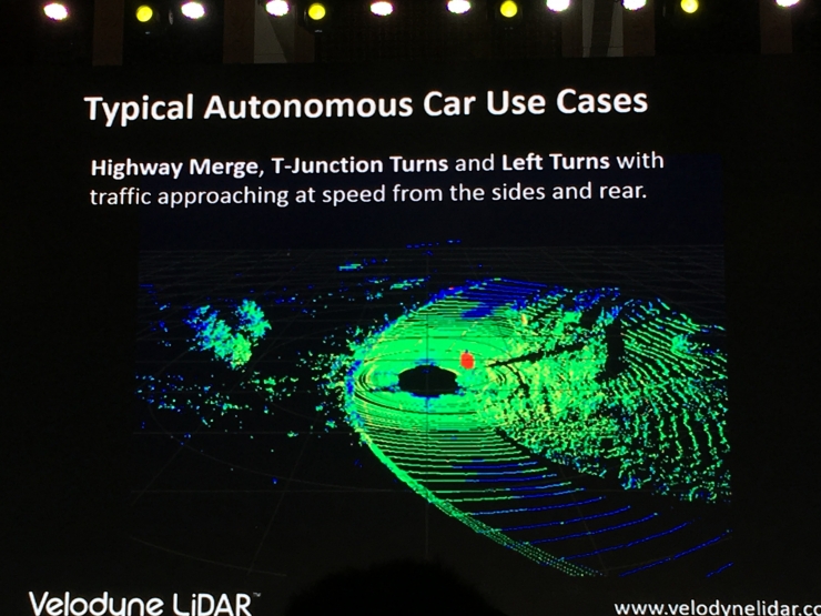
Within the scope covered by the test, there will be a right of way in the United States when driving on a motorway. What is strange in the United States is that no one has such a right of way. In the end, both are brave enough to win. When driving without driver, if we have a very good 2D map and video report in front of you, you can see it well in the system. This system will usually judge the object in front of it. It knows its focus and focus. Where is the face, the car has been driving toward the road. When it is on the road, it will know which roads are traffic jams and which instructions are very familiar throughout the neighborhood.
From a software point of view, we can simplify all the issues just discussed. This will bring many benefits. For example, you are now an urban planner. There are many vehicles on the road of a new type of big city. When you are planning a car, There will be a real-time control, such as where there are roadblocks, which areas have roads, or where there are construction sites. The road conditions are not very good. We can use the most accurate 3D images to capture.